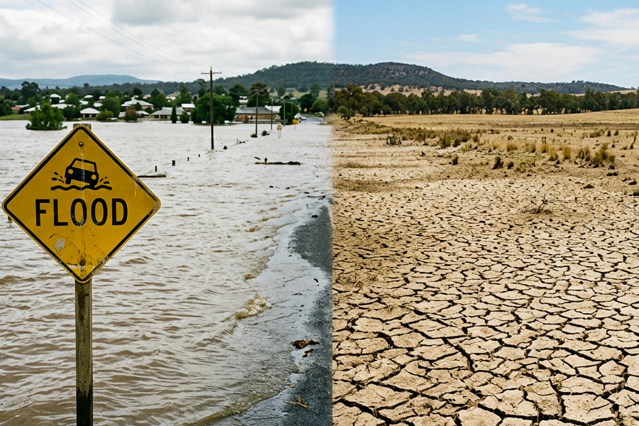
A stronger El Niño means more extreme weather, including droughts and wildfires in some places and flooding and tropical storms in others.
The super El Niño climate phase that has begun in the Pacific Ocean is already the strongest on record on some measures. When it peaks at the end of this year, sea surface temperatures in the east-central Pacific Ocean are projected to reach 4°C above normal, a 60 per cent increase over the old record.
As well as raising global temperatures, El Niño also shifts atmospheric circulation patterns, causing extreme weather around the world. This brings drought to some regions and flooding to others, damaging property and disrupting food supplies.
While the exact impacts vary from El Niño to El Niño, what’s clear is they will, on the whole, be stronger than in previous events.
“If you ramp up the size of your El Niño, you tend to ramp up the impacts in most regions of the world,” says Nick Dunstone at the UK Met Office, the national weather service. “It’s hard to know exactly which regions are going to be impacted the worst, but in general it’s fairly linear.”
How El Niño reshuffles the world’s weather
El Niño forms when trade winds weaken, allowing water they have pushed into the “warm pool” in the western Pacific to run back eastward. This huge blob of warm water heats the atmosphere.
When El Niño isn’t occurring, the heat of the warm pool causes moist air to rise into the atmosphere above it, with the moisture condensing and falling as rain over South-East Asia. At the same time, air sinks over the cooler eastern Pacific. The warm air aloft, now mostly free of moisture, flows in to replace it, creating a giant loop. This loop is joined up with similar loops that circle the global tropics in what is known as the Walker circulation.
But when the warm pool sloshes eastward across the Pacific during El Niño, the centre of rising moist air moves with it, shifting the entire Walker circulation eastward. As a result, the warm, dry air now sinks over South America rather than the eastern Pacific. Another loop of warm, dry air has also shifted and begun descending over South-East Asia and Australia. The Met Office is forecasting dry conditions in these areas over the next few months.
“The Amazon is a concern, as is Borneo and places in Indonesia and Australia as well,” says Dunstone. “Those are some of the regions that wildfire risk would be greatly increased.”
During the 1982-83 super El Niño, the “Great Fire of Borneo” destroyed 36,000 square kilometres of rainforest. Now, thousands of square kilometres of Borneo are burning again, with peatlands releasing huge amounts of carbon dioxide.
South-East Asia and South America: Droughts on one end; floods on the other
El Niño’s strongest and most reliable effects sit either side of the tropical Pacific – warm, dry conditions across Indonesia and Australia, heavy rain along the equator and into south-east South America.
Africa: Both extremes, months apart
El Niño typically dries the Sahel from July to September and southern Africa from December to February, with heavy rain arriving over the Greater Horn in between.
Asia: A monsoon that doesn’t arrive
El Niño years tend to bring a weaker Indian monsoon from June to August, followed by unusually warm conditions across southern and south-east Asia between December and February.
North America : Splitting the continent
A displaced winter jet stream warms Alaska and western Canada while steering storms across the southern US.
El Niño will push ocean temperatures to record highs
The natural climate cycle will amplify long-term human-driven warming, sending global sea surface temperatures far above their historical average.
On 26 August, global average sea surface temperature reached a new record. Seas around the world have been warming for years. But this new record is unusual because it comes in August rather than in March or April, when the global ocean is normally warmest after the austral summer. Part of the reason is El Niño.
“El Niño is adding heat to the system, but it is doing so on top of decades of human-driven warming,” Samantha Burgess of the European Union’s Copernicus Climate Change Service said in a statement.
El Niño pushes tropical storms eastward
A rare bit of good news from El Niño is that it reduces the likelihood of hurricanes hitting North America in summer and fall. These tropical storms in the Atlantic are fuelled by warm, moist air rising high into the atmosphere. But El Niño often intensifies high-level westerly winds, creating a contrast with weaker low-level winds known as wind shear that can disrupt this process.
“Tropical storms form better when they’re not being torn apart basically by the upper-level and the lower-level winds,” says Dunstone.
The Atlantic hurricane season has had the quietest start in almost 40 years, with only three named storms, all of them short-lasting. The US National Oceanic and Atmospheric Administration predicts that conditions will remain less active than normal and generate zero to two major hurricanes.
In the Pacific, however, winds are, in general, weaker than average, and the rising warm air can still generate large tropical storms. But because this convection has shifted eastward, the storms that make landfall in Asia have had more time to suck up energy from the ocean.
El Niño could make 2027 the hottest year on record
Global temperatures are projected to rise sharply in 2027 as the developing El Niño adds a temporary boost to long-term human-caused warming.
Amid all of this, global temperature invariably rises during El Niño, and this incredibly strong event is expected to amp it up even more than is typical. Because this comes on top of climate change, climate scientists are widely predicting that 2027 will be the hottest year ever observed.
Global temperature rise will almost certainly exceed 1.5°C. While that isn’t the long-term average that would be needed to officially fail the Paris Agreement goal of limiting warming to 1.5°C, it’s another nail in its coffin.
And a strong El Niño is often followed by strong La Niña, a cooling in the eastern Pacific that creates its own extreme weather.
“That would generally have the opposite impacts,” says Dunstone. “That can be an extra sort of stress on systems if they are changing like that.”
Original source: https://www.newscientist.com